Dreamway – Munich to Venice
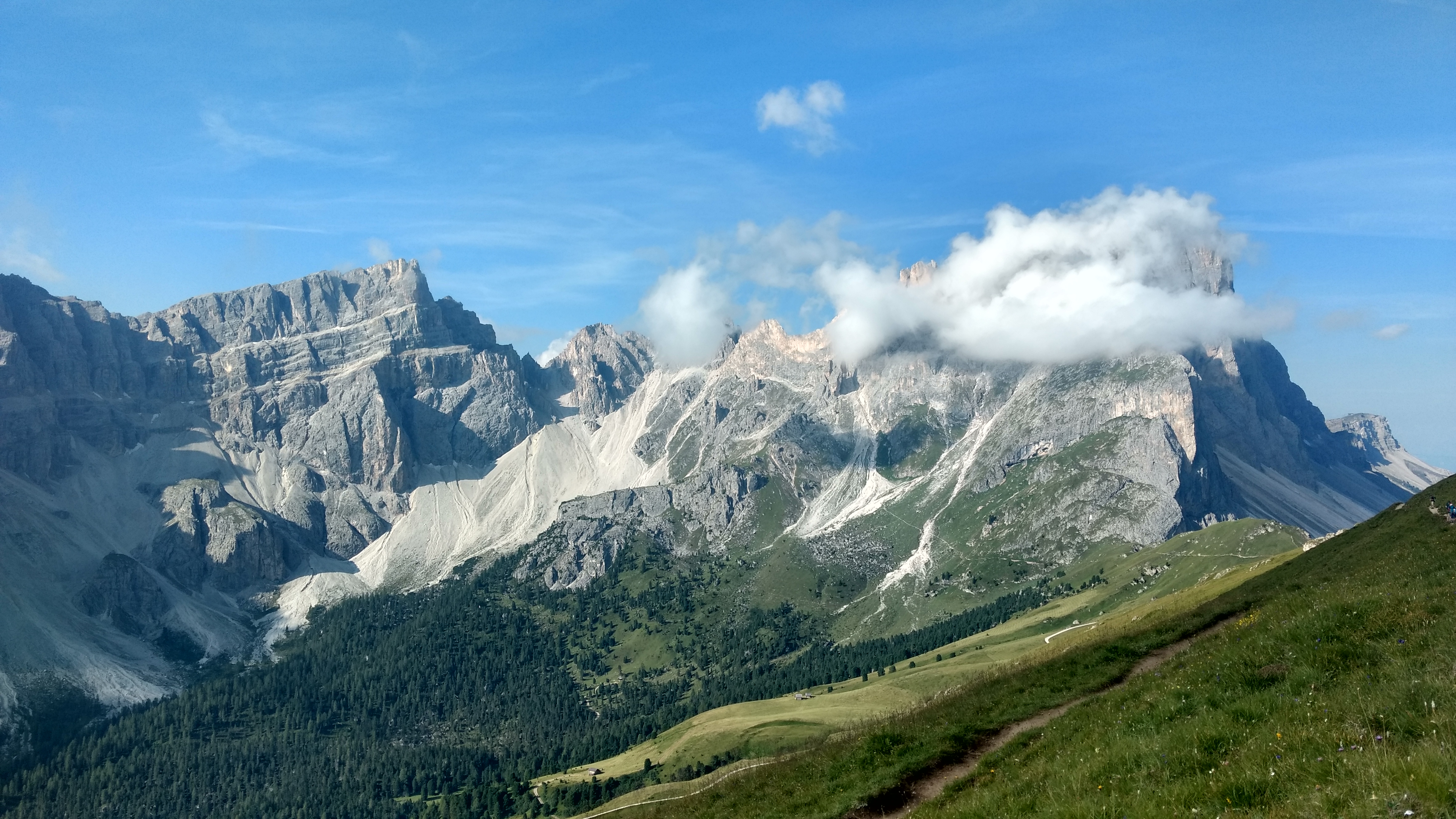
The Dreamway (der Traumpfad) is a German invention that runs from Munich to Venice, covering some 580 kilometers in total. This German classic is one of the best long-distance hikes in Europe as there are relatively few connector stages and a lot of high Alpine hiking with spectacular views. Add to this the incredible variation in landscapes (from the lush pre-Alps in Bavaria to the mediterranean Southern Dolomites), charming Alpine hamlets and the spectacularly located huts you’ll come across this hike offers a truly unique experience. If I were to pick my favorite hike in the Alps, this would be my pick.
Below you can find all the practical information I wish I knew before I started out, if you’re interested in my personal experience you can checkout my trailjournal.
Practical information about the Dreamway
The Dreamway can be divided into four segments. Each of these segments has its own character and challenges. Details are described in separate pages.
- From the pre-Alps to the Inn valley
- From the Inn valley to the Dolomites
- Northern Dolomites
- Southern Dolomites
Avoiding roadwalking
You’ll notice that in my descriptions I choose to exclude the stretch from Munich to the Alps and the stretch from the Southern Dolomites to Venice. That is because I wouldn’t recommend anyone to hike these stretches. I can not stretch enough how brutal an pointless these stretches are. Both stretches are brutal and feature prolonged and sometimes dangerous roadwalking with little to no scenery to make up for it. As they are mostly on tarmac and gravelled roads one is likely to develop serious injuries and blisters. Hiking long distances on these surfaces with a heavy pack is tough even for seasoned hikers. In fact, many people drop out due to overtraining injuries after just two days, even before reaching the Alps.
As the Dreamway is about crossing the Alps I recommend skipping these stages. You’ll save six days on you traveling schedule while missing nothing of the highlights. In my opinion, starting in Lengries and ending in the small village of Arfanta (in the heart of the Prosecco region!) makes much more sense. If I were to do the Dreamway again, this would be my plan.
Nature of the hike
This is a hard hike, don’t underestimate it. Most days have well over 1200 meter of ascent and descent. Combine this with a heavy backpack and the challenge is clear. Some of the longer days are really hard if you’re not 100% fit. Then there is the altitude and terrain. Most of the time you’ll find yourself in between 2000 and 2800 meter altitude and some stretches feature awkward scrambling. Crux passages are the crossing of the Karwendel between Karwendelhaus and Hallerangerhaus, the epic ridgewalk between the Glungezer Hütte and the Lizumer Hütte and the long, exposed and hard Via Ferrata between Rifugio Pian de Fontana to Rifugio 7th Alpini (you have to rent Via Ferrata gear for this stretch).
If you’re hiking solo I advise you to team up with fellow hikers for the sections above. If this is your first time in the mountains I also advise you to team up with an experienced hiker on the stretch from Lenggries to the Glüngezer Hütte.

Weather on the Dreamway
As the Dreamway is often high up in the mountains the weather plays a huge factor. When I did the hike in 2018 there were multiple days with rain and fog while temperatures stayed close to freezing. On other days the sun was out in force and temperatures were sometimes well over 30 degrees Celcius. Packing good rainproofs, light gloves and a warm down or fleece jacket as well as a sun hat is therefore crucial.
Thunderstorms are another big factor on the Dreamway (or in fact, anywhere in the Alps). Usually the weather follows the same pattern: A sunny morning leads to cloud building up, with isolated rainclouds and thunderstorms in the afternoon or evening. If a weather change is forecast, these storms can be stronger and more violent than usual and extra caution is needed. In any case, you should always keep an eye on the weather and ask for the weather forecast in the huts. This is especially true for stages where you’ll be up on a ridge as this often means you’ll be the highest object for miles around.
In general, the Norther half of the hike will be colder and wetter than the Southern part of the hike. The transition point is the small village of Pfunders, just South of the central Alps. From there on the wetter is likely to be warmer with more thunderstorms than on the North side of the Alps.

When to Go?
The Dreamway is best hiked in July and August. Any earlier and you’re likely to encounter significant snow in the Karwendel mountains, any later and the onset of autumn might prevent you from finishing. I would recommend an early July start as this means you’ll clear the Northern Dolomites before August, which is the busiest month. In late July and August it will be hard to find accommodation in the huts as they’re oftentimes fully booked weeks in advance.
If the forecast is good it would be possible to hike some stretches (such as the stretch from the Inntal to the Olpererhütte) in September but be aware that the shortening days make for colder weather.
Reaching the Dreamway
The Dreamway is very easily reached as it begins and ends in a major city and ends in a major tourist destination, both of which have a large, international airport. The recommended start of the hike, Lenggries takes only an hour to reach by train from Munich. The tiny town of Arfanta has no public transport connections it lies only an hour’s walk from Tarzo where you can catch the bus to Venice.
Along the way there are many chances to join or leave the trail. Most notably: Hall (near Innsbruck), Niedervintl and Belluno. These towns have great connections to nearby airports or direct train and bus connections bringing you back to Munich.
Accommodations
Accommodation is mostly in mountain huts and sometimes in rural pensions (see my article about the Berliner Höhenweg if you want to know more about hut life). An average overnight including half board costs about €45,- (in 2018). There are two ways to bring down costs: If you’re a member of a European Alpine Club you’ll get a discount in huts for accommodation and some meals (Bergsteigeressen). For a list of coöperating mountain clubs you can check this link about ‘Gegenrecht‘. Please note that the Alpine Club discount is only valid in Alpine Club huts. Private huts and pensions will give no discounts but you’ll find that most of them have very reasonable prices.
Another way to bring down costs is to bring your own food for lunch and breakfast. If you do this and order the bergsteigeressen you can bring down costs to about €25,- or lower. To do this you’ll have to carry food rations for up to eight days so be sure you’ll be able to handle the load.

Because the Dreamway (and especially the Northern Dolomites) can be very popular in the summer it is recommended to call ahead and make reservations a few days in advance. This leaves you plenty of time to think of alternative plans if you find the hut fully booked already.
Compared to other hikes, you’ll find limited wildcamping as the route is very often too high up and exposed. At other times wildcamping is strictly prohibited. In 2018 I carried a tent but it saw limited use. If I were to do the Dreamway again I would leave the tent and carry extra food to bring down costs.
Guidebooks and navigation on the Dreamway
At the time of writing there are two guidebooks about the Dreamway: A German one from Bergverlag Rother and an English one from Cicerone press. Sadly, the English guidebook doesn’t live up to the standards normally held by Cicerone Press. Following the descriptions of the English guidebook would see you miss out on useful information and exciting alternatives (such as staying in Arfanta). It would also make the trip very expensive as the book is written by a very rich retired manager who obviously doesn’t symphatise with hikers on a budget. Hotel and hostel recommendations in the larger towns seem to be random and very expensive indeed. I would therefore recommend the German book to anyone who feels confident reading German. If you’re not confident reading German it would be very useful to befriend some of the many Germans on the route.
Another helpful way to find the trail is the Alpenverein app. This application is made by the German Alpine Club and allows you to download the entire route as a whole or all of the separate stages as a GPS track on a topographical map for your phone. As the app doesn’t function properly on all phones it is wise to test it before you set out. To do this you can simply download the route and then switch off the app. Now turn on airplane mode on your phone, open the app and try to find the downloaded maps (these are hidden in favorites). If you can open them without internet you’re good to go. If not, you might want to try another app. At any rate, the GPS track may at times deviate from the ‘official’ route described in the Guidebooks. Be aware of this and compare the GPS track with the route described in the Guidebooks, then choose either one of them.